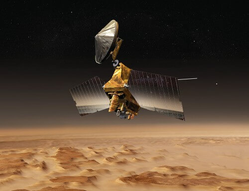
The photographs of the American probe MRO They uncovered a number of sloping slopes, where an underground ice sheet about 100 meters thick was exposed to the atmosphere. The ice sheet is covered in the rest of the places with a very thin rocky layer of only one to two meters, and may be used as an important and accessible resource for manned missions to the Red Planet.

Ice beneath the Martian surface is not a new discovery. The veteran Mars Odyssey probe, which began circling Mars in 2001 (and continues to do so to this day), She discovered Indirectly beneath the surface much ice is hidden, especially in mid- and polar latitudes. This discovery Confirmed Later by the Phoenix lander in 2008, which detected ice just below the surface. In addition, underground ice has been observed in fresh craters created by meteorite collisions, as well as by the radar instruments of the European Mars Express probe and the American MRO (short for Mars Reconnaissance Orbiter).
The radar device MRO's probe, which arrived at the planet in 2006, had previously shown that the ice could reach as deep as 10 meters below the surface in mid-latitudes, but its measurements were not precise enough to determine whether the ice could reach closer to the surface. In addition, the measurements could not determine the characteristics of the ice, such as how free it is of dust and rock particles.
Now, a new study published last week in the journal Science and based on MRO observations, reports the identification of eight sites on the planet where pure, solidified subsurface ice is only about a meter or two below the surface.
The researchers were able to reach this conclusion thanks to sloping slopes, up to 6 km long, in pits within the ice sheet that hides underground. On the slopes, the ice is exposed to the Martian atmosphere and provides a glimpse of its internal structure.
"There is shallow ground ice on about one-third of the surface of Mars, which records the recent history of the planet," said lead researcher Colin Dundas of the US Geological Survey's Center for Astrobiological Sciences. "What we saw here is transverse cuts in the ice, which give us a three-dimensional view with more details than ever before."

"It's like we have one of those ant farms where you can see through the glass from the side to learn about what's usually hidden underground," added Shane Burn of the University of Arizona's Lunar and Planetary Laboratory.
The thickness of the ice sheet exposed on the slopes reaches more than 100 meters. It is covered by a very thin layer only one to two meters thick, which itself is made of rock and dust stuck to each other through ice.
Based on visible cracks in the exposed ice, as well as the sharp slope of the slopes, ranging from 45 to 55 degrees, the researchers concluded that the underground ice is cohesive and strong. They also speculate that it is quite pure, containing only a few percent of dust and rock.
The sites where the slopes are located are located at mid-latitudes of 55 to 58 degrees on the planet, seven in the southern hemisphere and one in the northern hemisphere. For comparison, their location is similar to those of Scotland and the tip of South America on Earth.
One of the pieces of evidence that indicated that the exposed material on the slopes was ice was their bright, blue color in bold-color images of HiRISE (short for High Resolution Imaging Science Experiment), MRO's telescopic camera, which is the highest quality camera ever sent to the planet, with resolution That comes up to 0.3 meters per pixel.
The identification was confirmed in some of the slopes also using the probe's spectrometer. In addition, thermal measurements by the Mars Odyssey probe ruled out the possibility that the source of the water is not ice but a temporary frost cover, because the temperature measured was too high for the formation of such a cover.
The researchers are still not sure how exactly the slopes began to form, but when the ice is exposed to the very thin atmosphere of Mars, it begins to turn directly into gas (water vapor), in a process known as the mirror, and retreated slowly.
The comparison of the probe's photographs in a range of about 3 Martian years (one Martian year lasts 687 days, almost two Earth years) showed that the ice retreated at a rate of several millimeters per year. By determining this rate of retreat, the researchers assume that the age of the pits in the ice sheets, where the slopes were observed, is about millions of years, a very short time in geological terms.
But how exactly was the ice sheet exposed on the slopes formed in the first place? The researchers' theory is that it arrived there as snowfall, and over time solidified into solid ice. Ice could fall in these areas during those periods The inclination of the axis of rotation of Mars, that is, the angle between its axis of self-rotation and the plane of its orbit around the Sun, was very high, about 35 degrees or more. During such periods, the poles warm up, and the water ice that is currently trapped in them, "migrates" and sinks again in lower latitudes.
The inclination of the axis of rotation of Mars today is about 25 degrees, very close to the 23.4 degrees of the inclination of the axis of rotation of the Earth. But unlike Earth, whose changes in the tilt of its spin axis are limited thanks to the influence of its large moon, Mars does not have a large moon, and the tilt of its spin axis changes radically in cycles those who are attracted About 120,000 years.

The researchers note in their article that the ice on the slopes is divided into layers, "created as precipitation with differences in the amount of ice and dust under different climatic conditions". Therefore, the discovery may provide new insights regarding the climatic processes on Mars and the role of water in them.
"If there was a mission to one of these sites, where a sample of the layers deep into the slopes was taken, it would be possible to get an accurate history of the climate of Mars," said Leslie Tempre, deputy principal investigator of the MRO mission from the Jet Propulsion Laboratory. "This is part of the whole story of what happens to the water on Mars over time: where do they go? When does ice accumulate? When did he withdraw?”
In addition, ice so close to the ground may serve as an excellent and accessible resource for future human missions to Mars. Water could be used not only for drinking, but for producing oxygen for breathing and rocket fuel for the launch from Mars back to Earth. "Astronauts will actually be able to come with a bucket and a shovel and get all the water they need," Bern said.
At the same time, it should be noted that the location of the sites is not ideal for a manned mission on the planet: latitudes closer to the poles have less exposure to sunlight and the cold conditions are more extreme than at the equator. In addition, humans who will land on the planet in the future will certainly want to return to Earth, and at the equator the self-rotation speed of Mars is higher than at higher latitudes, so that a launcher that takes off from there into space will have a significant advantage in its initial speed.
See more on the subject on the science website:
- The solar wind has removed most of the Martian atmosphere
- It snows on Mars during the summer nights
- The Curiosity rover adds to a mystery that has plagued Mars explorers for years
- Why does part of the south pole of Mars look like Swiss cheese?
- For the first time, boron was found on Mars, a discovery that strengthens the possibility that life existed on it in the past

3 תגובות
Within 3 years of Mars and not an intermediary as listed. This is about differences between time periods.
two meters? really?? Two meters?!
You destroyed the site with the new design, who designed your site, Muhammad Shakshuka from Gaza???