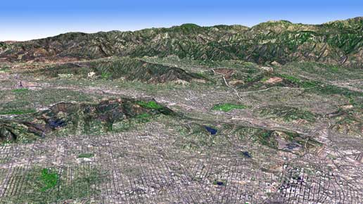
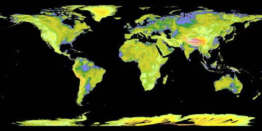
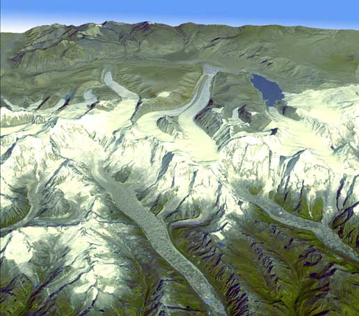
The accurate three-dimensional topographic data of almost all land areas on Earth will be used for engineering, energy exploration, natural resource conservation, environmental management, public works planning, firefighting, recreation, geology, city planning and more. The maps can be downloaded for free to anyone who wants them in high resolution

NASA and Japan release to the public a new topographical map of the Earth that covers more areas than ever before. The map was produced using detailed data from NASA's Terra spacecraft.
The Digital Global Elevation Model of the Earth was created from nearly 1.3 million pairs of stereoscopic images collected by the Thermal Emission and Reflection Radiometer (ASTER), flown aboard the Terra satellite. NASA and Japan's Ministry of Economy, Trade and Industry developed the database and it is now available to all users worldwide for free.
"This is the most comprehensive altitude database available for the entire world," said Woody Turner, ASTER program scientist at NASA Headquarters in Washington. "This unique global data series will appeal to users and researchers from a wide range of disciplines who require information about altitudes and other terrain."

According to Mike Abrams, ASTER's lead scientist at NASA's Jet Propulsion Laboratory (JPL) in California, the new topographic information will be a valuable addition to all involved in Earth science from the various aspects as well as practical applications. "ASTER's accurate data will be used in engineering, energy exploration, natural resource conservation, environmental management, public works planning, firefighting, recreation, geology and urban planning, to name just a few of the fields.
Until now, the most available topographic database was from the shuttle radar mission, this mission mapped about 80% of the Earth's land surface - between 60 degrees north and 57 degrees south - the areas over which the shuttles sail. The ASTER data covers 99% of the earth's surface - from 83 degrees north to 83. All the height measurement points in the new data are about 30 meters apart.
Aster data also fills in many of the gaps in the data collected by the shuttles such as extremely steep terrain routes and some deserts." says Michael Kubrick, a scientist in the Shuttle Topographic Radar Mapping Project at JPL. NASA is now working to combine ASTER data with that of the shuttles and other sources to produce an even better global topographic map.

NASA and the Japanese Ministry of Commerce are jointly contributing the Aster data to the Group on Earth Observations, an international partnership located at the International Meteorological Organization in Geneva, for use in the system of systems they are building - an international effort to unify data about the Earth from every device and every system to Assist in monitoring and forecasting global environmental changes.
NASA, the Japanese Ministry of Commerce and the US Geological Survey with the assistance of the US National Geospatial Intelligence Agency and other partners confirmed the validity of the information.
ASTE is a device for measuring the Earth that was launched aboard the Terra spacecraft in December 1999. The device photographed the Earth in the visible light and thermal infrared range, the spatial resolution is between 15m and 90m. A joint scientific team of Americans and Japanese validated and calibrated the instruments and the data.

8 תגובות
on Saturday 12/07/09
Interested in world maps
Does anyone have any idea what software should be used to open the maps that can be downloaded?
REGISTER You will register, fill out a questionnaire, enter a name and password, then it will develop a map for you, mark squares and download any file you want
Can't find the right link to download the pictures...
Moran
I didn't read the article, so correct me if I'm wrong, but I understood that the topographical data is only for parts of land (land) and not for buildings and things like that.
Are there any photos of the nuclear reactors in Iran?
Now you can plan bike trips in the Simian Mountains without leaving home