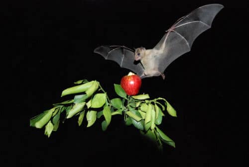
The two main researchers in the two studies published together in Science explain in a conversation with the science website the difference between the methods for collecting the data, and the fact that for the first time it is possible to track small animals and collect and analyze a large amount of data

A comprehensive description of the two studies in a separate news item - here
As we mentioned in a separate article, this evening (Thursday) two articles were published in the journal Science by Israeli researchers who reached a similar conclusion in two separate experiments in which they followed the movement of bats, one in the Hula Valley and the other in Tel Aviv. We talked to both researchers and tried to understand the differences between the studies
In a conversation with the science website, Prof. Yossi Yuval explains: We were able to prove that bats have a cognitive map. They know how to take shortcuts in flight between two familiar locations but on an unfamiliar road and that they do this by relying on their sense of sight. They go up in height, look and see landmarks such as perhaps the Azrieli Towers and we guess that they make an azimuth for some such bodies and based on that calculate where they need to go. Sonar enables navigation over a short range, not sure that even on a scale of hundreds of meters.. These are supplementary senses, fruit bats have excellent vision. It is assumed that they use the sonar to complete the long-range navigation for example when they are near a tree and want to estimate the distance to it. We have another study that at short distances they know how to translate an echo into a visual representation in their brain.
The important feature of our research is that we follow puppies from the day they are born, from their first day outside they know how to take shortcuts. It is unclear whether they are born with this trait or learn it during their first two weeks in the cave. In any case, we discovered that from a very early age they have mapping abilities. Obviously, to navigate they need to see because it's a visual map. As they grow and enrich the map in front of them, they can shorten and navigate over great distances. The ability is in them from the age of zero."
"As for the evidence, there is a series of evidence, for example the fact that the bats rise above the buildings when they take a shortcut. We also rule out the use of scent, the direction of the wind does not affect the navigation which does not become more accurate if there is a head wind or a tailwind that does not allow the scent to reach the bat. In any case, the ability to build the cognitive map has never been tested in small animals."
Can you explain the difference between the technologies used in the two studies?
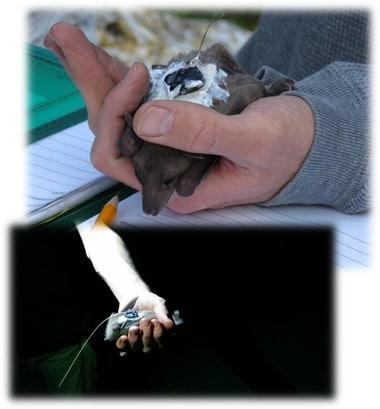
Prof. Yuval: "The difference is that with us we use a GPS that stores the data, and then when the bat returns to the cave we download the data, which means we need direct contact with the animal twice. In the Atlas system developed by Prof. Ran Natan's group together with computing researcher Prof. Sion Toledo from Tel Aviv University, they installed transmitters on the bats and received the signals in the antennas scattered on the surface. The advantage - you don't have to catch the bat again to download the data, the disadvantage - it only covers the area where the antennas are, each of the technologies has many uses. Atlas is the most advanced reverse GPS in the world and we also use it in our research."

Prof. Ran Natan from the Hebrew University explains that the Atlas system was installed on cellular antennas throughout the Hula Valley and its surroundings - including on the slopes of the Galilee and Golan mountains. In total, an area of about a thousand square kilometers was covered - 25 by 35 kilometers. "The Atlas system enables high-frequency and low-cost tracking of relatively small animals over time and with great accuracy. Of course, the price is that the system is limited to a certain area, where the signals can be received: "We took the GPS technology and brought it down to ground level, or rather on the mastheads of cellular companies. This way we were able to cover the entire area with 14 antennas."
"We use the Atlas system mainly for studies that focus on where the animals spend most of their lives. This is a fantastic technological innovation that is generating great interest in the world. Because it was impossible to do such studies before we developed Atlas and we had already established such systems in Great Britain, Germany, Holland and other sites in Israel. From the moment of the establishment of the scourge we can absorb millions of data per day. It's unlike anything that's happened before. For example, my first PhD student 15 years ago followed for three years after scouring the Eilat area he found 500 locations. Today, even 2.5 million data are found per day. We jumped 5-6 orders of magnitude. We use methodologies that produce high-throughput data."
"The person who led the research, a PhD student of mine named David Shahmi, succeeded, in addition to the work in analyzing the data and taking over the writing, together with me, to map all the fruit trees in the Hula Valley, the number of which reaches tens of thousands. Thanks to the work, we knew with great precision to which tree the bats fly from the moment we trapped them for five months. We examined whether the trajectories depend on age, whether they change over time, all analyzes show one result that repeats over and over again that they fly in straight lines directed to the forest. It does not change as a function of the time of the shortcut. Both young and adult bats. Our conclusion is that they are building a cognitive map because they are not doing a random search that would have created a tortuous path. Since we know where each of the trees is, the probability that they will randomly fly to their tree is low. We tried to check whether simpler mechanisms could cause these results, and we found no such mechanisms. However, we invalidated their use of landmarks on an ongoing basis, perhaps only when they are building their cognitive map."
0
Israeli scientific discovery: fruit bats navigate using a "cognitive map" based on vision
"Motion Ecology", an innovative research approach to the study of the movement of living creatures, was developed at the initiative of a researcher from the Hebrew University
New findings about how bats use their natural sonar to detect and hunt insect swarms
The whiz of the bat

One response
Well done!
First and foremost to the researchers, but I also want to praise the editor who was not content with citing the news but also talked to some of the researchers. This is an important part of the added value of the site.