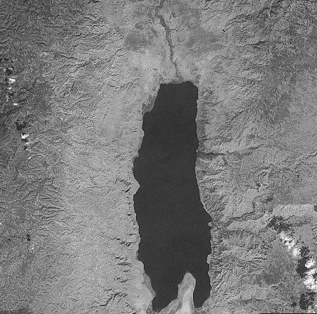
Dr. Efrat Morin from the Hebrew University developed methods to warn against floods in the Dead Sea area using radar

In recent years we have witnessed a large number of high-intensity flood events in Israel and around the world and are aware of the high cost in lives and damage to infrastructure. In just the last two years, there have been two flood events in the Dead Sea area that caused casualties. Forecasting floods and giving warnings about them is a difficult problem that occupies many researchers. Dr. Efrat Morin from the Department of Geography at the Hebrew University has developed a method that will make it possible to warn of floods in the Dead Sea streams (beds and level) using a meteorological radar system.
Warning using meteorological radar is based on remote sensing technology that allows receiving data on the intensity of rainfall in real time, with a high resolution of time (every few minutes), of area (every square kilometer) up to a distance of about one hundred kilometers. This system is unique and different from the standard rain measurement systems that do not give sufficiently detailed information about the rain clouds.
A major part of Dr. Morin's research focuses on the development of a hydrological model that represents the processes that occur in the drainage basin of a stream when it rains. The model calculates the part of the water that is stored and flows on the surface and in the river channels and can warn when and where the flood will occur. These days, the development of the warning model for Argot and Darga rivers in the Dead Sea is being completed. Later, the research will be expanded and applied to all the streams that drain from the west towards the Dead Sea.
"Utilizing the advanced technology of the meteorological radar system in combination with a hydrological model helps us better understand the rain systems and floods that are created and can make it possible to predict these floods in advance" explains Dr. Morin. "With the help of the system and the model, we can reduce the danger of injury to the soul and infrastructure caused by floods. Admittedly, there is some uncertainty in the use of the system and the success is not XNUMX percent, but by investing in radar technology that increases the accuracy of the measurement, we can improve the system even more."
The research was conducted in collaboration with the Ministry of Agriculture's Drift Research Station and funded by the Ministry of Science through the Dead Sea R&D. The research was recently presented at the annual meeting of the Geological Society and at an international conference in France.

2 תגובות
This is a really great idea.
This reminds me of an article I read the last few days (and sent to Roy and my father in the hope that they would find a free source for the public describing the same things) in which a system with an idea somewhat similar to the idea here is described. It is a system for warning against earthquakes that is based on laptops with accelerometers that continuously measure their accelerations and are spread over large areas.
The hope is to give a few seconds warning to allow people to defend themselves.
They simply notice the beginning of the tremor in certain areas and warn in all places.
I hope you also notice the similarity.
Cool.