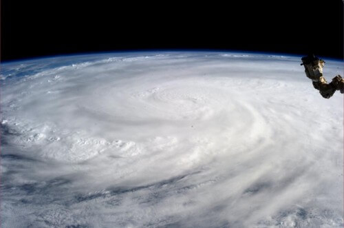
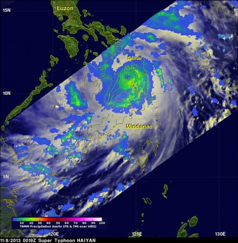
Haiyan is classified as a category 5 tropical storm according to the Saffir-Simpson scale. It hit the center of Giwan city, which is at the southern tip of Eastern Samar province, on Friday at 04:45 local time.

Super typhoon Haiyan hit the island nation of the Philippines on Friday, November 8 with winds estimated at 315 km/h according to the US Navy and the Typhoon Warning Center and left a huge area of death and destruction in its terrible path.
As of this writing, the death toll is estimated at at least 10,000 people and may even rise. Local media reports bodies of men, women and children washed ashore. The enormous scale of Super Typhoon Haiyan was only captured when watching the storm from space and indeed satellites of NASA, the Indian Space Agency and Russian satellites as well as astronaut Karen Nyberg who flew over the storm on the International Space Station photographed it.
Super Typhoon Haiyan is probably the largest and most powerful storm to ever hit land in human history. Haiyan is classified as a category 5 tropical storm according to the Saffir-Simpson scale (the difference between a hurricane and a typhoon is only in the location - the Atlantic Ocean or the Pacific Ocean, in both cases these are tropical storms. A.B.). It hit the center of Giwan city, which is at the southern tip of Eastern Samar province, on Friday at 04:45 local time. When the storm reached the center of the Philippines, NASA estimates that the wind gusts reached an enormous speed of 380 km/h. The storm brought with it waves 10 meters high, which flooded the coastal areas and caused mudslides.

The high-resolution photographs provided by the many satellites of various countries watching the Earth are essential for monitoring deadly storms and they also provide early warning capability to evacuate residents from areas in danger to minimize the number of deaths and damage. This time too, over 800 people were evacuated.
The storm is now making its way to Vietnam.

5 תגובות
We have already rescued some 200000 Filipino nursing workers from the storm. Israel sends and will send aid with all its might and success to the rescue and humanitarian aid teams
What a shame for our country without aid to the Philippines
Asaf, tomorrow the initial team should arrive in the area to check what exactly is needed, the team that includes the rescue and aid forces will join them soon
Israel should offer aid, and help. If there was an earthquake in the country, we would want them to offer us help. Even if it is only moral support.