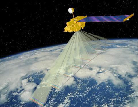
The method developed by Prof. Uri Dayan from the Department of Geography at the Hebrew University and Dr. Itamar Lenski from the Department of Geography and the Environment at Bar-Ilan University is based on the analysis of satellite information that allows for the identification with great precision (1 kmXNUMX) of areas prone to extreme weather conditions

Researchers from the Hebrew University and Bar-Ilan University have developed a new method to identify and map climatic phenomena of great importance to agriculture using satellites. This method will help in the planning and management of agricultural systems as well as in preparing for extreme climatic phenomena, accurate planning of the times of pest control, planting and harvesting of agricultural crops, and as a result will reduce the expected damages to agriculture and the economic damage to the farmer.
The development of agricultural crops and the spread of agricultural pests depends on the climatic conditions prevailing in the area. The method developed by Prof. Uri Dayan from the Department of Geography at the Hebrew University and Dr. Itamar Lenski from the Department of Geography and the Environment at Bar-Ilan University is based on the analysis of information received from a satellite of the American Space Agency NASA, and by means of which it is possible to identify with great precision (1 kmXNUMX) areas prone to conditions extreme weather. The uniqueness of the developed method is that, unlike a normal weather forecast that refers to large areas, the forecast received from the satellites provides an answer at the local level of a single plot.
According to the method, the description of which was recently published in the leading journal Bulletin of the American Meteorological Society, the satellite measures radiation at different wavelengths which is converted to temperature. The researchers checked what the ground temperatures were during the day and at night in areas prone to extreme conditions in the last 10 years and built a model to describe the behavior of the climate. The model built by the researchers revealed climatic phenomena in the affected areas that cannot be detected in the existing measurement system.
"Preliminary and accurate identification of local climatic phenomena is very important for determining the rate of growth of field crops and the development of pests in the field" says Prof. Dayan. "The early detection allows for efficient planning and management of agricultural systems, the timing of the pest control and the planting and harvesting for the years to come."
"A system that allows early planning of the actions required for agriculture is especially essential against the background of the growing global food crisis" says Dr. Lansky. Today, despite all preventive and pest control measures, about 40% of all the world's grain is lost to diseases and pests. For example, the timing of the pest control is critical to eradicating the heliotis moth, which damages a large number of essential agricultural crops such as tomatoes and corn. Using the new method, planning the pest control according to the climate forecast can be managed at a regional level that will control the optimal dose and prevent the development of pest resistance to the pesticides.

3 תגובות
A satellite still can't and won't be able to for a long time to be accurate to the level of the plant
Precision agriculture today is only by aircraft
Could this improve weather forecasts?
Contrary to the existing predictions, which are sometimes correct and sometimes not
Is it possible to put the name of the scientific article in the article?