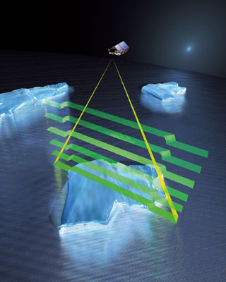
The Cryosat-2 satellite scheduled for launch on February 25 will allow the deepest glimpse into the polar ice

After a $207 million rebuild, Cryosat-2 should release data by September - says Mark Drinkwater, head of ESA's Science Missions Department. During a three-and-a-half-year stay in satellite orbit, Cryosat-2 will collect information on the polar ice every 30 days from an altitude of 715 km, and will record changes of centimeters in the thickness of the ice by measuring the height of the ice using microwaves. Because microwaves penetrate clouds better than the infrared used by NASA's ICESat satellite, the satellite will allow unprecedented surveillance in cloud-covered areas like Greenland.
"I think the effects of climate change are felt the most in terms of the changes in the polar ice masses," says Drinkwater. An accurate determination of their thickness will help predict polar temperatures, sea currents in the oceans and perhaps most importantly, for the Earth's population, a rise in sea levels. – Corey Binns
More missions to be launched soon
Mission: Solar Dynamics Observatory
Who: USA Launch: February
Three minibus-sized cameras placed aboard the observatory will monitor solar activity to help scientists understand the mechanism behind the sun's behavior and the solar cycle.
Mission: Prizma
Who: Sweden Launch: February
The two Prizma spacecraft, Mango and Tango, will dance together in a satellite orbit and test technology that could lead to independent space flight by using a combination of GPS, satellite tracking cameras and radio transmitters.
Mission: Kanopus-V/Belka-2
Who: Russia/Belarus Launch: Spring
The show will send two satellites into orbit around the Earth to collect data on natural and man-made disasters, track wildfires and pollution, and monitor natural sources.
Mission: Planet-C
Who: Japan Launch: Not yet decided
The Venus Climate Orbiter, or Planet-C, will orbit Venus, photographing the surface and measuring atmospheric winds, in an attempt to gain information about the planet's undeciphered atmosphere. The information may also help to understand the evolution of climate on Earth.
Mission: Chasqui 1
Who: Pro Launch: November
Peru's first nanosatellite will take pictures with the aim of discovering the remains of ancient cities beneath the forest tops. – Brooke Burrell

One response
Drinkwater(!)
It seems to me a suitable name for the type of research that employs him.