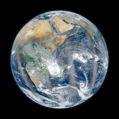
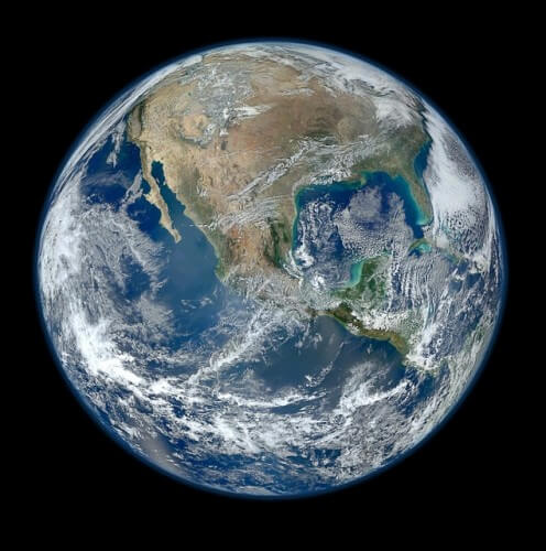
A new high-resolution photograph of the Blue Earth was taken by the new observation satellite of NASA and the sister agency NOAA (Oceanographic and Atmospheric Agency) as well as in cooperation with the US Department of Defense which has also recently received a new name Suomi NPP

A new high-resolution photograph of the Blue Marble was taken by the new observation satellite of NASA and the sister agency NOAA (Oceanographic and Atmospheric Agency) as well as in collaboration with the US Department of Defense which was recently also given a new name Suomi NPP.
The satellite took a large number of images on January 4, 2012, and NASA prepared an image consisting of thin strips of the Earth. The images (one showing the western half of the Earth and the other the eastern with Israel at the top) give the viewer a view with a resolution of 1.6 kilometers per pixel. The satellite that photographs the Earth in a synchronous orbit with the Sun, meaning it reaches every point at the same local time, orbits the Earth at an altitude of 824 kilometers. He sees all the glory of the country every day. This is the first of a new generation of satellites that will watch the Earth change.

The satellite, whose original name was the National Polar-orbiting Operational Environmental Satellite System Preparatory Project (NPP) has now undergone a name change and its new name is Suomi NPP in memory of the pioneer of the use of satellites, Werner Suomi.
The first photo released was a tribute to the popular "Blue Marble" photo taken by Apollo 17 crew members on their last trip to the moon, showing the Americas. NASA and NOAA also released a complementary image - showing the eastern half of the Earth. This image was also assembled from six high-resolution images taken on January 23 by the satellite.
The images were prepared by scientist Norman Coring of NASA's Goddard Center. The point of view in the picture is of an observation from a height of 12,742 kilometers above the earth from a latitude of 10 degrees south and 45 degrees east. The four straight 'fog' lines in this image show the reflection of sunlight from the oceans. In reality, the photo was taken from a lower altitude, from which she does not see the entire earth at once, but the combination of the many photos she took that day gives this illusion.

9 תגובות
I don't understand how people train for this nonsense. Investigate the matter in depth and you will realize that the earth is as flat as a pita
The shell is terribly thin.
This is all we have and we are destroying it with our nothingness and our hedonism.
Desert and wilderness we deserve and this is what we will get.
Beautiful pictures
The pictures show the destruction we are doing to our house...
Just what, 30 years ago? North America used to be pretty green, and now most of the continent looks like an arid desert…
The "blue marble" on the weight of the blue lagoon?
Thanks Yossi, the high resolution photos are simply amazing.
Precisely on that day Israel was cloudy...
In the picture you can see that the land belongs to the Jews
It's a shame that there are a lot of typos and typos... it shouldn't be so typical for a site that talks about knowledge):
In such an article, to complete the enjoyment, it is advisable to give links to high-resolution images.
http://npp.gsfc.nasa.gov/images/VIIRS_23Jan2012.jpg
http://npp.gsfc.nasa.gov/images/VIIRS_4Jan2012.jpg