Seedling and digging out - drones and capsules are not: companies around the world are developing new technologies for planting trees from the air quickly and efficiently

By Maya Falah, Angle, Science and Environment News Agency
If once only a little rune in the heart and in the hand was enough, today to try to catch up with the rate of forest depletion on the planet New technologies are developing around the world, with the aim of helping large quantities of trees to return and spread over large areas.
There is no doubt that there is an urgent need for trees: not only do they provide a place to live and shelter for entire societies of diverse animals, they also have countless benefits for humans - they provide shade, help improve the situation our psyche, and perhaps most of all, they can delay the effects of climate change. Because while man emits huge amounts of carbon dioxide into the atmosphere in the process of burning fossil fuels and leads to climate change on Earth, trees absorb the same gas and use it to build the building blocks of their bodies. In fact, trees serve as a huge reservoir of carbon dioxide, so they play a key role in reducing the amount of carbon dioxide that is released into the atmosphere.
The problem is that as humans keep multiplying on Earth, they need more land for living and farming, as well as wood as fuel and for use in various industries. The result is that as of 2015, approximately 76 thousand square kilometers (kmXNUMX) of forests were cut down in the world every year - an area slightly larger than the entire area of Panama. Even though the natural regeneration of existing forests and the efforts to plant new forests and trees bear some fruit and reach about 43 thousand square kilometers per year, it is still a loss of 33 thousand square kilometers of forest every year, an area the size of Taiwan.
With the forecast for a population of close to 10 billion people in 2050, it is difficult to see how the world will succeed, at the current rates of planting and natural tree regeneration, to meet the needs of the growing population, while also leaving enough trees to grow peacefully in their place.
Forests are born from the air
A new report that was published recently by two leading nature and environmental organizations in the world (World Resource Institute and The Nature Conservancy) reveals that within this crisis may be hiding a golden business opportunity: those who have been able to develop technologies that are able to plant trees more efficiently, are probably sitting on a gold mine. According to the report, the countries of the world have already committed to dedicate areas with a total size of over 1.6 million square kilometers to forest restoration in the coming years, an area 30 percent larger than the area of South Africa. The report invites investors to join the celebration and invest in projects aimed at restoring land and landscapes.
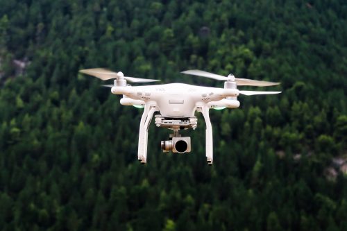
One of these leading ventures is that of the Technologies Company BioCarbon Engineering, which developed advanced technology for planting trees in large areas using drones. According to the company's founder, Dr. Lauren Fletcher (an environmental engineer by training and a former NASA employee), the technology they developed, which uses a drone to plant trees in large areas, is able to effectively plant 120 capsules containing tree seeds in just one minute. This means that through the latest technology, assuming theoretically that all the seeds germinate, two new trees can be released into the world every second. In reality, in laboratory and field experiments, 20 percent germination and initial growth were obtained in temperate regions and 70 percent in tropical regions - percentages similar to those obtained by manual sowing.
https://www.youtube.com/watch?v=JcJ7vLwtSIM
The tiny unmanned aircraft developed by the company and named "Robin" is used for more than just the planting itself. In the first step, the drone was sent to the designated area in order to carry out scans and photographs from the air, to help the company's employees understand the route of the area and its texture, the distribution of vegetation and the variety of species that may already be in the area - this in order to plan the method of planting, as well as to assess which type of tree would be the most suitable for planting in the field In the second stage, "Robin" approaches the work of planting: he carries a sort of small, concentrated capsules, which contain the seed accompanied by nutrients that are supposed to help it grow and grow optimally at its destination station.
While hovering at a height of about three meters above the ground, "Robin" shoots the capsules underground, where the moisture causes the capsule - which is coated with a biodegradable coating - to break down and release the seed to grow peacefully. "Robin" is also supposed to return once in a while to the area to monitor and assess that the forest is indeed recovering according to the plan set for it, and that the trees are growing successfully.
Drones in the forests - also in Israel
You might be surprised to learn that drones are already being used in Israel today for the purposes of forest management. "We do not use drones for planting purposes, because this technology is suitable for large areas, and not for the limited areas we have here in Israel," explains Dr. David Brand, head of the forestry division and chief forester of the National Fund for Israel. "However, we do use drones mainly for the purposes of monitoring our forests, an operation that can immediately give us a reliable picture of the area - which in the past would have required a careful ground inspection."
According to Jania Danisiuk from the forestry department at the foundation, KKL-Junk started monitoring its forests using drones as early as 2015, when it won a tender for aerial photography using TerraScans Labs drones. "Using drones saves a lot on the use of manpower," she explains, "so, for example, when we carry out survival surveys - that is, checking what has survived in the forest after planting within five years of it - the drones can cover an area of about 10,000 dunams a day. When it is done on the ground, on the other hand, a team of two surveyors goes out, which on a good day can only cover about 300 dunams."

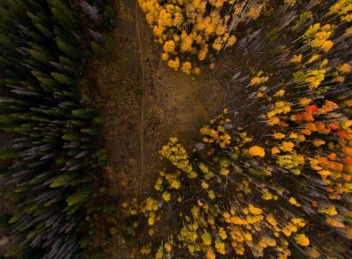
The variety of operations for which KKL-Junk uses drones is increasing all the time, according to the perfection of the technology. "We use drones to monitor ground phenomena that occur in the forest, among other things to use them for management and planning decisions," says Dr. Michael Sprintsin from the Forestry Division. "It is not always possible to reach every corner of the forest on foot, or to know exactly what and where to look for. The drones allow us to monitor large areas and find indications of problems. They allow us, for example, to draw conclusions about the health of the forest: using the drones we monitor the phenomenon of plant dehydration, and the aerial photographs allow us to identify the focal points of dehydration, and make an assessment of the extent of the phenomenon."
Does not change foresters
The drones are also used to monitor targeted events such as fires - an event that has the potential to cause enormous damage to forests. "In real time it is indeed impossible to launch drones into the air," Sprintsin explains, "but as soon as the fire is over we can upload them to maps and document the state of the area, and understand its severity and the damage to the vegetation. This allows us to make an assessment of the number of trees that were burned, and to do it in a much more immediate and accurate range than before."
"In addition, we also use drones to monitor the current activity in the forests - for example, measuring the visits to the forest," says Sprinzin, "During the holiday season, for example, we used drones to estimate the number of visitors to popular sites, and through the aerial photographs we were able to calculate how many visitors arrived in a certain period of time. We also use them to map our forest areas: updating the forest boundaries, updating the roads, sorting the species in the forest. This information allows us to create a forestry map that we use on a daily basis, and to make it more accurate than what can be done from the ground."
So the drones may not yet be able to replace the KKL-Junk foresters, but there is no doubt that they save them a lot of work and optimize it. "It is true that when we talk about more complex situations - for example in different states of tree health such as damage to the tree from various pests - it is often necessary to accompany the activity of the drones with targeted ground inspections", Brand concludes. "But in general, this is a very big revolution: whether it is fire damage, snow damage or the drying out of trees, we have a tool in our hands that can give the area managers and foresters a very broad picture, already within 24 hours after the event, and over much larger areas than we could cover by using only our legs".
See more on the subject on the science website:
