This is how Dr. Gidi Bar, a researcher at the Geological Institute, explains in an interview with the Hidan site. According to him, the eruption was preceded by the rise of the "filler" material from the depths of the earth and a series of moderate earthquakes.

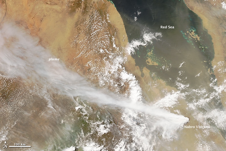
Nabro, a dormant volcano in the northeastern African country of Eritrea came back to life in the late evening of June 12, 2011 in eruptions preceded by a series of earthquakes.
The MODIS Medium Resolution Spectrometer on NASA's Aqua satellite captured the image the next day in natural colors.
(For information on the NASA website)
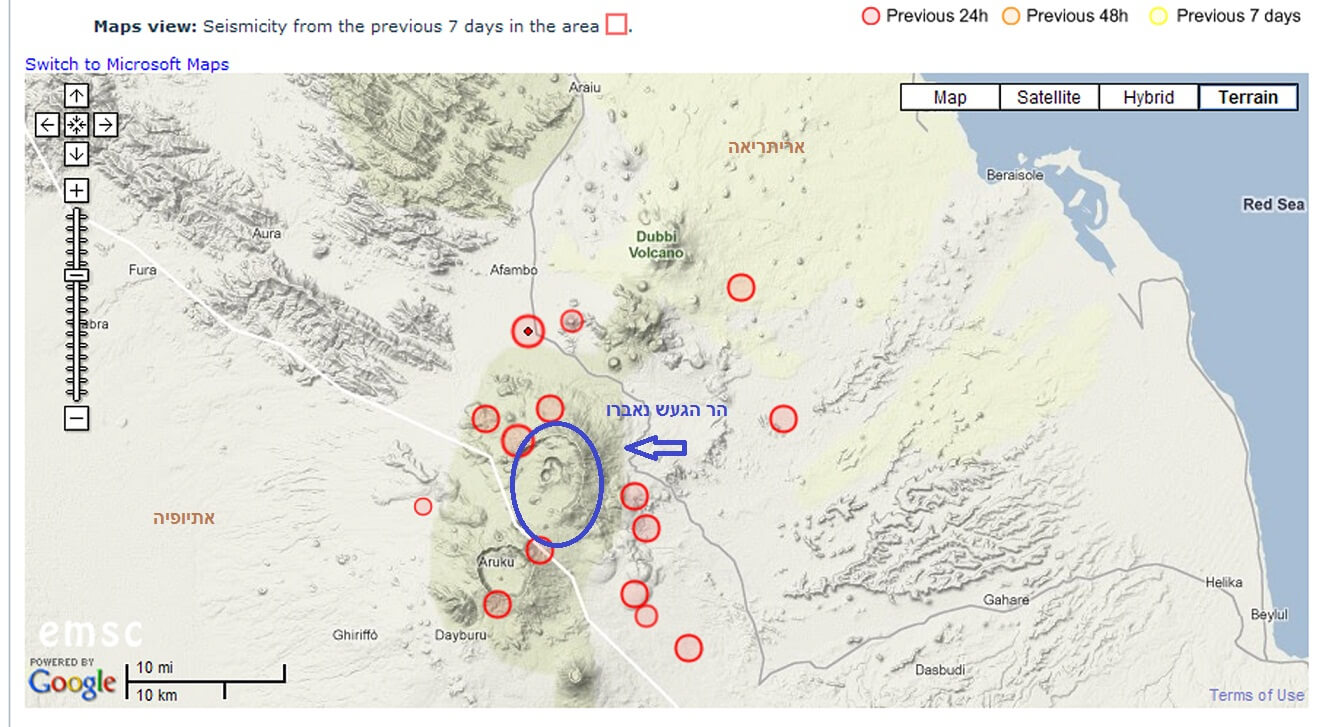
First reports from the news agencies and the Volcano Information Center in Toulouse, France, believed that the mountain that erupted was Dobi, which is further north and which is known to have erupted about 150 years ago, but more recent reports from volcanologists, scientists in the field and satellite images confirmed the eruption of Navarro. No eruption of Navarro is known to date.
The volcano is part of a system that includes several craters. It is part of the East African rift, where the African continent splits in two due to plate oscillations.
The ash cloud made its way north and west, and in the morning it was already seen hovering over Eilat, although at a relatively high altitude of about 14-15 kilometers. At this point, the flights to Eilat were not stopped because they are carried out at much lower altitudes of about 3-4 kilometers.
To understand the background to this eruption, and precisely to a volcano whose last eruption is unknown, we spoke with Dr. Gidi Bar, a researcher of earthquakes and volcanoes at the Geological Institute.
"We all know the Syrian-African rift that runs through our eastern border. This rift is our local expression for the displacement of the plates in which the Arabian plate moves east and north and the African plate moves west and south."
"While in the Jordan Valley and the Arabah, the two plates move side by side, in the continuation of the rift in the end sea, the continental plates begin to move apart and in the space created between them, new material is constantly rising from the earth's mantle. The rift does not end at the southern border of the Red Sea. In this area it splits. One arm continues towards the Indian Ocean eastward from Bab el Mandab Egypt (in the Djibouti area), another arm turns a little west, goes up to the land in Eritrea, and continues into Ethiopia, where it connects with the East African fault that continues south towards Kenya. Another arm connects the Gulf of Djibouti directly with the East African rift, thus creating a triangular shape trapped between the sections of the rift. This triangle is called the Afar triangle (AFAR). Part of it (the Dankil Basin) is even below sea level, similar to the area that stretches from north of the Sea of Galilee to the Dead Sea."
Dobi and Navarro volcanoes are between the main sections of the rift, and also where the continental plates separate - one to the east and one to the west. As at the bottom of the ocean, here, too, occasionally material rises from the mantle that cools at a shallow depth of several kilometers, and forms the form of dykes, which actually fill the seam between the plates. Every such increase of dykes is accompanied by a series of earthquakes and indeed in the last day in the border area between Eritrea and Ethiopia about 15-20 moderate earthquakes with a magnitude of 4-6 occurred. At some point the earthquakes stopped and the internal pressure increased to such an extent that the material came out of the mouth of the Navarro volcano, which was probably prone to disaster (about 12 hours passed between the last earthquake and the eruption of the volcano).
When talking about the ash, it is not difficult to remember the volcano that erupted about a year ago in Iceland, how can the current eruption be defined in comparison to that eruption?
Dr. Bar: It's hard to talk about power - the ash rose to a higher altitude than the volcano that erupted in Iceland a year ago. It is about a height of 14-15 kilometers compared to 8-9 kilometers in Iceland, but the amounts of ash and probably their concentration were, in my estimation, less than those in Iceland. It should be noted that this is also a function of time and it is not clear how much longer the Navarro volcano will continue to spew ash. In Iceland it continued for several weeks and here it may stop quickly. Already now, two days after the outbreak, I read on one of the professional websites that it is already weakening."

Later we will also try to bring opinions of experts in meteorology about the ash cloud.

2 תגובות
My daughter, when she left school because she stayed at 7 o'clock, saw smoke coming from the west.
There was a smell of burnt plastic. I saw it too.
A bit worrisome, we are also on the verge of this.
It is possible that Ho "comes to life" and a chain of earthquakes will now begin in our direction 🙁