New dunes on Mars
Avi Blizovsky and Amir Burnett
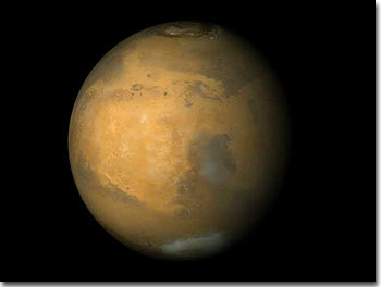
New dunes on Mars 4.2.2000
New images of Mars reveal young dunes just a few years old and others so old that they have evidence of ancient impact craters.
Mars Global Surveyor's images reveal the actions of Martian storms, which reach speeds of hundreds of kilometers per hour and can form in a few minutes and coat the entire red planet in a mantle of sand. Martian storms have been known since they began to observe giant storms passing over the Red Planet, but nothing more was known about it until 1971, the year Mariner 9 became the first spacecraft to orbit a planet other than Earth. The new images show that the dead star is not dead meteorologically at least as far as the sand dunes are concerned. In the first two pictures you can see the newly created dunes (note that this time they distinguish between meters and yards).
In the first picture there are dunes that are a few months old, in the second picture you can see the dark material drifting on top of the old, light dunes. On the other hand, in the third photo, the dunes for some unknown reason appear to have frozen in place, compared to an area where the strong winds managed to create new dunes.
XNUMXD map of Mars
The first comprehensive 4.8D map of Mars, made with the help of data sent by a NASA spacecraft in orbit around it, reveals an extreme landscape of extremely high mountains and extremely deep valleys, the processes that caused their formation have not yet been deciphered. Among other things, you can see on the map the highest volcano observed in the solar system to date and the largest crater. According to the scientists, Mars resembles a pear in shape, with the southern hemisphere being mountainous and prominent, and XNUMX km higher on average than the northern hemisphere.
The Hellas Crater in southern Mars, known to astronomers for many years, is probably the deepest on the planet. David Smith of the Goddard Space Center, who described the findings in an article in the journal Science, said that new measurements reveal that the lass - which is 9.6 km deep and 2,400 km wide - was created by a giant asteroid impact at the beginning of Mars, about 4 billion years ago.
If the United States had been hit by the same body, Smith said, the crater would have stretched from the East Coast to the Rocky Mountains, and rocks and objects flying from the impact could have covered the United States in a mantle 3.2 miles (XNUMX km) thick.
The new map was created from data collected by an instrument on the Mars Global Surveyor spacecraft, which entered orbit around Mars in 1997 and began its scientific mission a year ago. The device, called MOLA (Laser Altimeter Mars Orbiter), fires pulses of infrared laser beams at the surface of the planet, and determines their height by measuring the time it takes for the beams to reach the ground and return. The scientists drew the map using 27 million Measurements collected in March and April this year and last summer.
Carl Pilcher, NASA's Solar System Science Director said: "These data will serve as a basic reference book for many years to come for scientists studying Mars, and will inspire a variety of new insights into the geological history of the planet."
The spacecraft continues to collect about 900 measurements per day, and this data will be used to prepare a more detailed map in the next two years, equivalent to one year on Mars. A more advanced map will be used to study the evolution of Mars and the ancient processes that shaped its surface, scientists said, and will also help select landing sites for future missions to it.
Researchers are already using the information to examine an area near the South Pole, where the Mars Fuller Lander is scheduled to land on December 3.
Mars was once wet
A huge ocean covered the northern hemisphere of Mars millions of years ago
New York Times
The great hope of the Mars Polar Lander developers was that the spacecraft would find water on Mars. This hope was disappointed of course. But while they sat frustrated, hoping to get a sign of life from the wayward spacecraft, those scientists could read in the journal "Science" about a study that also dealt with water on the surface of Mars, and based on new evidence the hypothesis that the northern lowlands of the planet were once, more than a billion years ago, The bottom of a vast ocean (by the way, editors at "Science" firmly claim that the loss of the Mars Polar Lander had no effect on the timing of the publication of the article).
This is very convincing evidence. "This study proves the existence of an ocean on the surface of Mars with the same degree of probability that we know that dinosaurs once walked the surface of the earth," says planetary geologist Victor Baker. "My colleagues and I accept the new findings as extremely strong circumstantial evidence for the past existence of oceans," says another geologist. "I can compare it to a detective who finds a smoking gun on a murder suspect."
The Brown University researchers examined six categories of evidence, all of which were found to support the hypothesis of the ocean's existence. The findings, based on data from the Mars Global Surveyor spacecraft that has been orbiting Mars for two years, include clues to ancient coastlines and terraces that indicate flattening wave action and other processes that occur as oceans retreat. Another clue is that the central fissure of the area is unusually flat and smooth, which suggests accumulations of the types of mud and sediments typical of the seabed.
Dr. James Head, head of the team of researchers, says that the presumed ocean on Mars covered about one-sixth of the planet's surface. That is, it was larger than the Mediterranean Sea and the Arctic Sea combined.
Although the findings did not contain any direct evidence of the existence of life on Mars before the drying of the ocean, the past existence of large amounts of water is a good indication that in the past life thrived on the surface of the planet.
(The following segment was published in Walla Mada news on March 11)
One of the hidden secrets of the mysterious planet, Mars, was revealed yesterday by scientists - with the help of a telescope engaged in mapping the planet and a ground vehicle exploring its surface, the researchers discovered remains of raging rivers of water that flowed across its surface in the past.
Gravity measurements carried out below the surface of the earth indicate that at the beginning of the star it went through a long cooling period, and probably also stagnation. The information further proves that large water reservoirs were formed on its surface and flowing rivers flowed through it. According to the structure of the star's shell, which reaches 80 km in some places, the researchers estimate that the flow of water on the star caused the formation of valleys and ravines. The length of one of the rivers is about 1600 km and its width is about 200 km. These findings indicate the existence of an ocean in the distant past of the planet
