Following the discovery, the Antiquities Authority and the Natural Gas Routes to Israel company updated the engineering plan for the construction of the natural gas line, and the find will be preserved as an open archaeological site

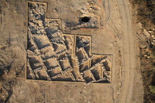
The remains of a rural settlement that existed for about two hundred years during the days of the Second Temple, were uncovered in the months of August 2013-January 2014, near Derech Burma (near Mitzvah Harel). The findings were uncovered in an archaeological rescue excavation carried out by the Antiquities Authority prior to the construction work of the national project to lay the natural gas line to Jerusalem, a project led by the Natural Gas Routes to Israel Company ("Netgaz").
In June 2013, Netgaz began the implementation of the project, which is 35 km long, starting in the Shefala region and ending in the outskirts of Jerusalem. Following the findings, the Antiquities Authority and Netgaz agreed on updating the engineering plan for the construction of the natural gas line, for the purpose of bypassing the site and preserving it as an open archaeological site alongside the Burma Road.
In the area of the excavation, which covers about 750 square meters, parts of a small rural settlement were uncovered with a number of small stone houses, and a network of narrow alleys between them. The plan of each house, which was probably used for the residence of one nuclear family, includes several rooms and an incense courtyard. According to Irena Zilberbud, the director of the excavation on behalf of the Antiquities Authority, "for the most part, the rooms were used for living and storage, while in the courtyards the various household chores were done."
The site, whose name has not survived, is located at the top of a spur at a height of 280 meters above sea level, and from there there is a view of the surrounding areas. These vast areas of land were used - then as well as now - for growing orchards and vineyards, which formed the economic basis of the early settlers of the area.
The excavations showed that the site reached the peak of its development during the Hellenistic period (during the third century BC) when the Judean region was under the rule of the Seleucid kings, the successors of Alexander the Great, and it reached its end at the end of the Hasmonean rule.
Dr. Yuval Baruch, an archaeologist in the Jerusalem area, points out that "the phenomenon of the abandonment of villages and agricultural farms at the end of the Hasmonean period or at the beginning of the reign of Herod the Great will be recorded in the government, is known in many rural sites in Judea, and it may be related to the extensive construction projects that Herod carried out in Jerusalem, and especially the construction The Temple Mount, and the migration of many villagers to the capital city to take part in this enterprise."

The reasons for the cessation of life on the site are unknown, but it can be assumed that they are related to financial difficulties and not to a violent incident.
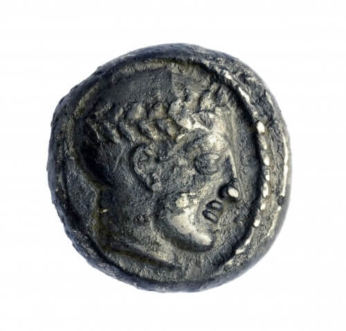
In the excavations, many and varied finds were discovered, from all periods of the settlement at the site, including crushing and grinding tools from basalt and limestone that were used for home cooking, pottery cooking utensils, storage jars for liquids - oil and wine, pottery oil candles that were used to light the houses, and over 60 coins, including coins from the The reign of the Seleucid king Antiochus III, and even from the time of the Hasmonean king Alexander Yanai.

2 תגובות
Chutzpah!
In the fence, the new gas line passes under the park with an amusement park (Park 7 adjacent to Route 7).
Near the park there are also kindergartens and residences.
Of course, his request to the National Transportation Safety Board and the Ministry of Infrastructure to move the line to the southern side of Route 7 was not answered.
Because that's how it is in Israel - the lives of the suckling residents are not worth compared to 2300 year old antiquity.
Gedera is within the range of rockets from Gaza, what will happen if Iron Dome misses a rocket that will fall in Park 7 and hit the gas pipeline?
Yesterday, there was a short article about it on Channel 1 View