Satellite tracking may protect World Heritage sites

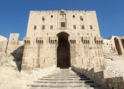
The citadel of the city of Aleppo (in the photo) rises above the old city in northern Syria, and contains the remains of palaces, mosques and baths from the tenth century BC. However, this world heritage site is now in danger due to the civil war in the country, between the rebels and the Syrian army under President Bashar al-Assad.
Battles and natural disasters threaten human life and cultural sites, but sometimes it is impossible to get to the place to assess the damage. Instead, experts are using satellite technology to monitor and protect endangered museums, landmarks, and other places of historical importance. The first operation of this kind was conducted by the International Council of Museums (ICOM) in collaboration with the Operational Satellite Applications Program of the United Nations Training and Research Institute (UNOSAT), with the aim of reporting on what was happening in the South Ossetia region, during the war between Georgia and Russia in 2008. The UNOSAT program uses a network of public and private satellites to photograph the situation from above. With the help of these photographs, and the coordinates of the cultural sites in the area, ICOM performed an assessment at the level of the single house in just 24 hours. ICOM has since used the satellites to survey damage to ancient mausoleums in Timbuktu caused during the 2012 Mali civil war and plans to use them to assess the devastation caused by the 2010 Haiti earthquake.
In places where conflicts are in progress, it is sometimes impossible to intervene, but satellite technologies and image analysis can provide the Council with enough information to raise international awareness, contact combatants on the ground and prepare plans for reconstruction in the midst of the fighting.
The article was published with the permission of Scientific American Israel
