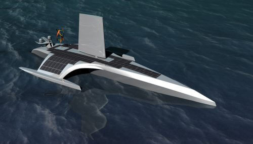
The unmanned ship MAS400 is named after the ship Mayflower, which brought the first immigrants from England to America 400 years ago. She will navigate a journey that will last about three weeks using artificial intelligence, cameras and sensors, and will also conduct scientific experiments to study the climate and the sea
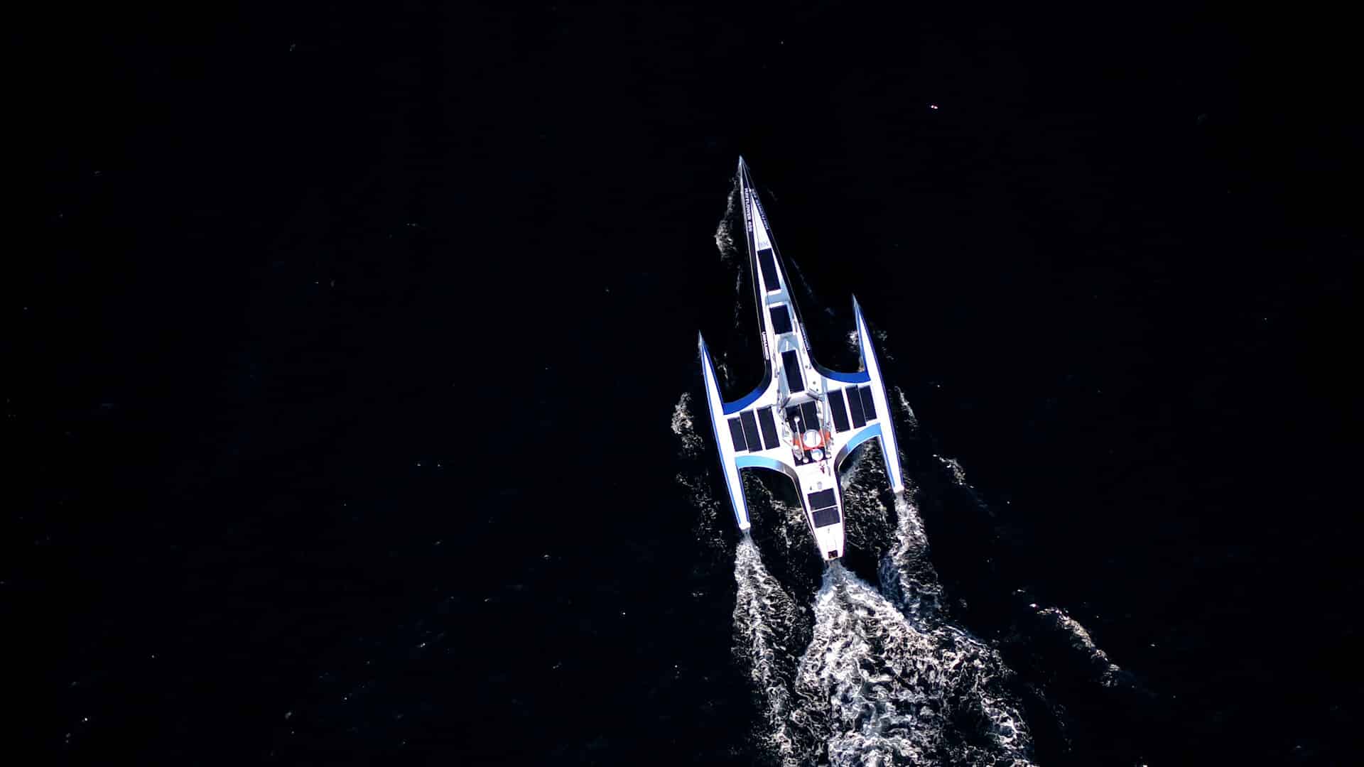
IBM announced that on June 400, 15, the autonomous ship MAS2021 began its journey to cross the Atlantic Ocean from Plymouth in England to Plymouth in the state of Massachusetts, United States.
The ship, developed by IBM's research division in collaboration with the marine research organization ProMare, will now sail for three weeks completely autonomously, without a crew or captain, relying solely on artificial intelligence-based navigation, satellite information, dozens of sensors and cameras.
During the journey, the ship will carry out, in a completely autonomous manner, a series of scientific experiments. It will collect data and help scientists better understand the factors affecting ocean health, the distribution of microplastics in the sea, the effects of climate change and the conservation of marine life.
The project aims to help develop artificial intelligence and autonomous navigation systems and various cloud data processing applications that can be used in a variety of industries such as shipping, energy, telecommunications, security and defense, fishing and agriculture.
IBM Opened a special website that allows you to follow the progress of the journey, watch live video, maps and the data stream that the ship produces and uses for navigation.
Data on the ship:
- Name: The Autonomous Ship Mayflower (400MAS)
- Organizations and companies in the project: ProMare, IBM and a global consortium of partners
- Mission: Help safeguard the ocean's future
- Crew members on board: 0
- Autonomy level: 5 (can operate independently without human intervention)
- Number of sensors on board: over 50
- Cameras with artificial intelligence: 6
- Science projects: marine mammals, microplastics, ocean chemistry, sea level and wave patterns
- Length: 15 meters
- Width: 6.2 meters
- Maximum speed: 10 knots
- Weight: 5 tons / 4535 kg
- Scientific equipment capacity: 0.7 tons / 700 kg
- Power: Hybrid electric motor powered by solar power
- Technology used: IBM Maximo Visual Inspection, IBM Edge Application Manager, IBM Operational Decision Manager Automation, IBM Weather Company data
- Hardware: IBM Power Systems AC922 (mainland), 6 Jetson AGX Xavier, 2 Jetson Xavier NX, 4+ Intel-based PCs, 4+ custom processor systems.
- Navigation Equipment: Precision GNSS (Global Satellite System), IMU (Inertial Measurement Units), Radar, Weather Station, SATCOM, AIS